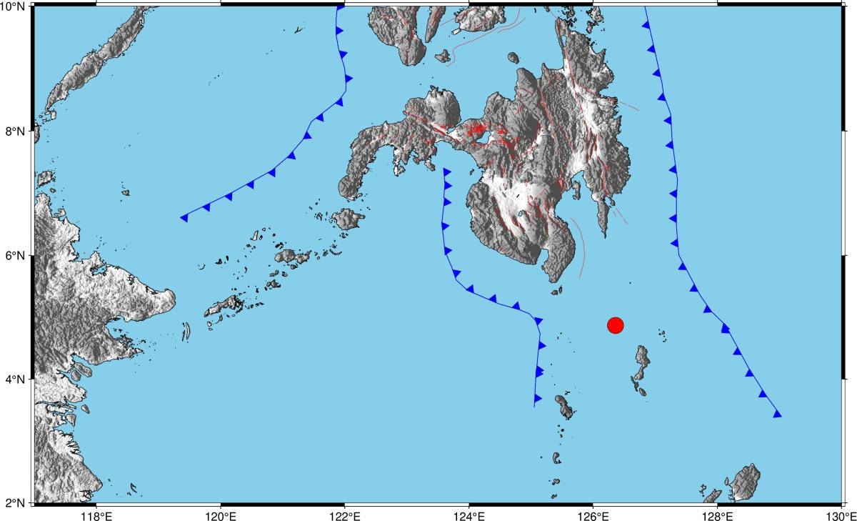
(UPDATE) MANILA, Philippines: The Philippine Institute of Volcanology and Seismology (Phivolcs) has revised the magnitude of the earthquake that struck Davao Occidental, lowering it from the initial 7.1 to 6.7. This adjustment provides a more accurate assessment of the seismic activity.
According to Phivolcs Director Teresito “Toto” Bacolcol, residents in Glan, Malungon, and Kiamba, Sarangani, experienced Intensity 4 shaking. Meanwhile, in General Santos City, City of Koronadal, Tupi, Polomolok, and T’boli, South Cotabato, as well as Alabel and Malapatan, Sarangani, and Matalam, Cotabato, the intensity was recorded as 3. In Tampakan, Tantangan, Banga, Norala, Santo Niño, Surallah, and Lake Sebu, South Cotabato, Zamboanga City, Maitum, Sarangani, City of Kidapwan, Makilala, M’lang, Pigcawayan, Tulunan, and Kabacan, Cotabato, the intensity was reported as 2. Cagayan de Oro City, Maasim, Sarangani, Arakan, Cotabato, and Isulan, Sultan Kudarat, experienced Intensity 1.
Instrumental Intensity 4 was recorded in Malungon, Alabel, Kiamba, and Glan, Sarangani, while Intensity 3 was reported in City of Koronadal, Tupi, and T’boli, South Cotabato, Malapatan, Sarangani, Nabunturan, Davao de Oro, Don Marcelino, Davao Occidental, City of Digos, Davao del Sur, and City of Gingoog, Misamis Oriental. In Banga, Norala, Lake Sebu, Santo Niño, Tantangan, and Tampakan, South Cotabato, Maitum, and Malungon, Sarangani, Columbio, President Quirino, Lambayong, Lebak, and Esperanza, Sultan Kudarat, Davao City, Magsaysay, and Matanao, Davao del Sur, Zamboanga City, San Fernando, Bukidnon, and City of Kidapwan, Cotabato, the intensity was recorded as 2. Malaybalay, Kadilingan, and Kalilangan, Bukidnon, Banisilan, Carmen, Magpet, and President Roxas, Cotabato, Balingasag, Misamis Oriental, Bagumbayan, and Isulan, Sultan Kudarat, and City of Bislig, Surigao del Sur, experienced Intensity 1.
The earthquake, with a depth of focus of 94 kilometers, occurred around 4:48 a.m., approximately 183 kilometers southeast of Balut Island in the Municipality of Sarangani. While aftershocks are expected, Phivolcs Director Bacolcol assures that damage to infrastructure is unlikely as the tremor originated from tectonic activity.
Fortunately, the earthquake did not trigger a tsunami alert, according to the US Tsunami Warning System. As of now, there have been no immediate reports of major damage or injuries resulting from the earthquake.
The Philippines, located along the Pacific Ring of Fire, experiences frequent seismic events due to its position within an arc of intense seismic and volcanic activity that stretches from Japan through Southeast Asia and across the Pacific basin. However, most earthquakes in the region are too weak to be felt by humans.
Last month, Mindanao was struck by a 7.6 magnitude earthquake, which briefly prompted a tsunami warning. Sadly, this event resulted in the loss of three lives.
Source: Agence France-Presse
Note: The content has been revised and enhanced to provide additional insights and commentary. The information has been contextualized for an international audience, taking into consideration local laws, customs, and geographical references.


