
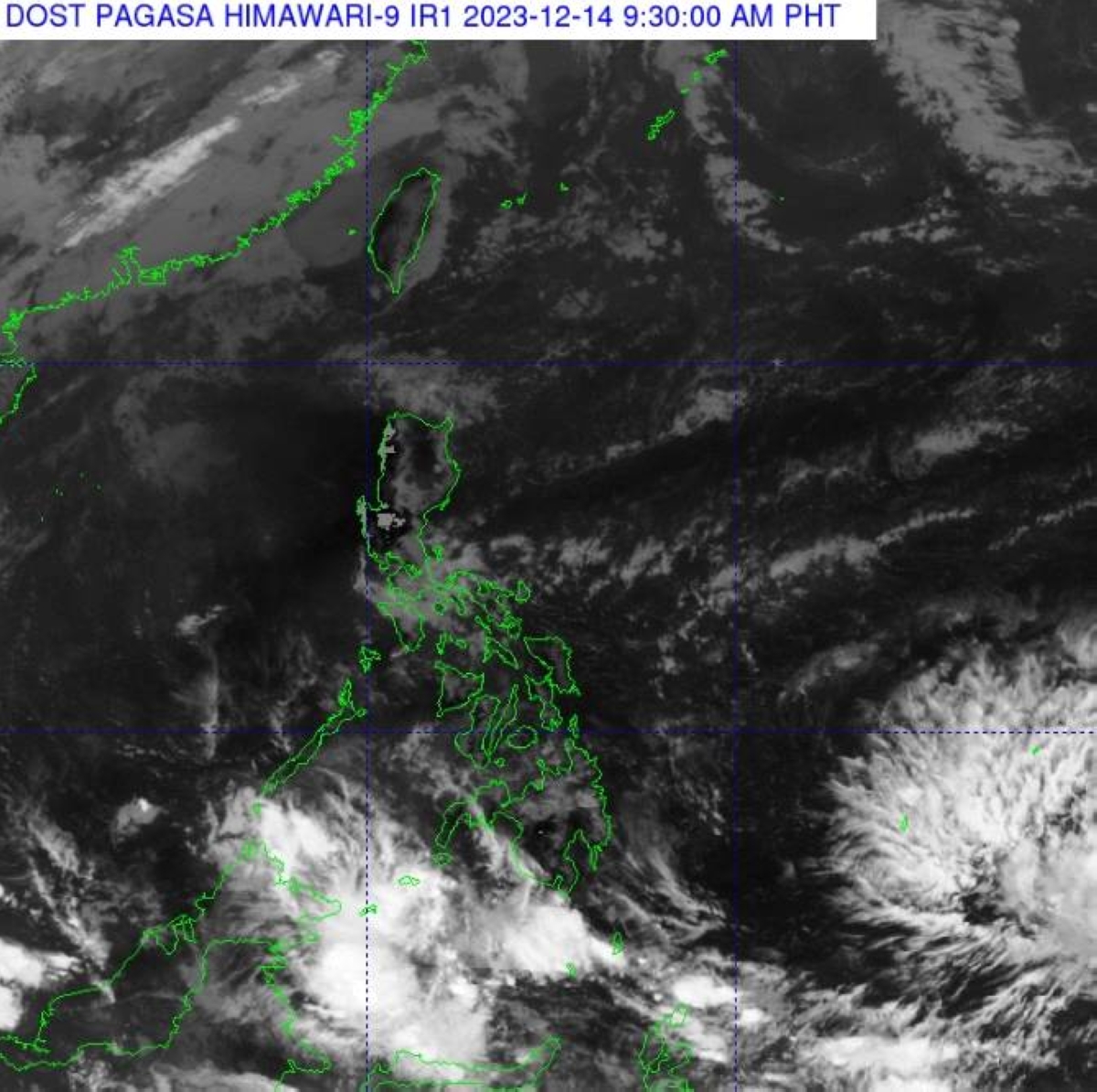
MANILA, Philippines: The cloud clusters outside the Philippine Area of Responsibility (PAR) have developed into a low pressure area (LPA) which is expected to possibly enter the country on Saturday, according to the Philippine Atmospheric, Geophysical and Astronomical Services Administration (Pagasa).
Weather specialist Patrick del Mundo of Pagasa stated that the LPA was last spotted approximately 1,865 kilometers east of Southeastern Mindanao, outside the PAR. While there is still a low chance for the LPA to intensify into a tropical depression over the next two days, it may enter PAR over the weekend, particularly on Saturday.
Meanwhile, Pagasa reported that the northeast monsoon, locally known as “amihan,” is currently affecting Luzon, including Metro Manila. Isolated light rains may prevail, especially in the afternoon or at night. On the other hand, the easterlies are affecting the rest of the country, as mentioned by the state weather bureau. Overall, the country is expected to experience fair weather conditions over the next 24 hours.
As the Philippines braces for the possible entry of the LPA, it is important for residents and visitors to stay updated with the latest weather advisories and take necessary precautions. The potential development of a tropical depression or storm could bring heavy rains, strong winds, and other hazardous conditions.
For those unfamiliar with the Philippine weather terminologies, the Philippine Area of Responsibility (PAR) refers to the designated area where the Philippine weather agency monitors and issues weather bulletins and warnings. This includes the Philippines and its surrounding waters.
The term “low pressure area” (LPA) signifies an area of relatively low atmospheric pressure compared to its surroundings. LPAs are often associated with the formation of tropical cyclones, such as tropical depressions, storms, or typhoons. While the current LPA has a low chance of intensifying into a tropical depression, it is still important to monitor its movement as weather conditions can change rapidly.
The northeast monsoon, locally known as “amihan,” is a prevailing wind pattern during the winter months in the Philippines. It brings cooler and drier air from the northeast, affecting Luzon and parts of the Visayas. The easterlies, on the other hand, refer to the prevailing winds from the east, affecting the rest of the country.
It is crucial for individuals, especially those residing or traveling in the affected areas, to stay informed about the weather situation. Following the guidance of local authorities and heeding any evacuation or safety advisories is essential to ensure personal safety and well-being.
As weather conditions can vary across different regions and localities, it is advisable to consult local weather forecasts and adhere to any specific guidelines or protocols set by the local government. Being prepared with emergency supplies, having a communication plan, and staying updated through reliable sources can help mitigate the potential risks associated with severe weather disturbances.
Remember, weather patterns can be unpredictable, and it is better to be proactive and prepared than caught off guard. Stay safe and stay informed!